October 22, 2025 – Repetitive Loss Area Analysis DRAFT 5-Year Update
Repetitive Loss Area Analysis 5-Year Update: The Town of Shandaken is in the process of developing a 5-year update to their FEMA Community Rating System (CRS) Repetitive Loss Area Analysis (RLAA). This analysis takes a deeper look into potential sources of repetitive flooding that has impacted insurable structures over the years and qualifying mitigation actions that align with land use, property owner actions, and/or larger mitigation actions such as structural elevation or acquisition. Under the process of a 5-year update, a voluntary online survey has been developed for citizen engagement. To participate in the online survey, CLICK HERE. To participate in the survey in person, a representative of the Town will be available Monday, August 25th from 11 a.m.-2 p.m. to visit with citizens at the Town Hall lobby, 7209 NY-28. The draft Repetitive Area Analysis will be made available on the Town’s Flood Information webpage for review and comment. Information shared by citizens will remain anonymous for reporting purposes and may be referenced with the Town’s annual repetitive loss area analysis progress report. CLICK HERE to review the draft RLAA, we encourage you to utilize the online survey to share your experience and feedback, CLICK HERE.
Floodplain Resources:
One of the primary sources of flooding in the town of Shandaken is the Esopus Creek. Significant flooding occurred between March 21st and March 22nd, 1980. During this flood event, a storm produced localized heavy rains over a short period of time, an estimated six million dollars in damages for Shandaken. During early April 2005, rainfall near the Esopus Creek basin ranged between 2 and 5 inches in a 48-hour period. More recently, there was flooding associated with Tropical Storm Irene. On August 28th, 2011, this storm caused major flooding and damage along the Esopus Creek, where between 4 and 11 inches of rain fell. This led to the highest rate of water discharged for Esopus Creek (75,800 cfs) (FEMA FIS, n.d.).
Quick Resources:
- Click HERE for core town documents including Flood Hazard Mitigation Plans
- Click HERE to find out if your property is within the regulatory floodplain. This link accesses the Ulster County Parcel Viewer, an interactive mapping system allowing users to search by street address to identify property in relation to effective flood zones (FEMA Special Flood Hazard Areas or SFHA’s).
- Click HERE to view the Town of Shandaken, Flood Damage Prevention Ordinance This link accesses Chapter 77 of the Shandaken Town Code, regulating development / encroachments within a mapped FEMA Special Flood Hazard Area.
- Click HERE for Information on the Floodplain Development Permits (FDP) Program. This link explains the purpose and provides a summary of fees associated with the Town’s FDP review and approval process.
- Click HERE for Guidance on Floodplain Development Permit (FDP) Application. This link provides information on which steps are required to apply for a FDP.
- Click HERE for information on Construction Standards within a FEMA Special Flood Hazard Area. This link provides details regarding several types of development within the SFHA, as well as standards for all structures, standards specific to residential versus non-residential structures, manufactured homes and recreational vehicles, accessory structures, and critical facilities.
- Click HERE to learn more about flood information. This link provides useful information to users about floods, including flood maps, flood risk awareness, flood insurance, preparation before the flood, and recovery after a flood occurs.
- Click HERE to access the Town of Shandaken’s “Emergency Cards” This link provides users with ‘printable card(s)’, providing citizens with emergency alert sign-up information, first responder phone contacts, as well as contact information for other Town offices and services.
Turn Around Don’t Drown®
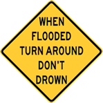
Each year, more deaths occur due to flooding than from any other thunderstorm related hazard. The Centers for Disease Control and Prevention report that over half of all flood-related drownings occur when a vehicle is driven into hazardous flood water. The next highest percentage of flood-related deaths is due to walking into or near flood waters. People underestimate the force and power of water. Many of the deaths occur in cars swept downstream. Many of these drownings are preventable. Never drive around the barriers blocking a flooded road. The road may have collapsed under that water. A mere 6 inches of fast-moving flood water can knock over an adult. It takes just 12 inches of rushing water to carry away most cars and just 2 feet of rushing water can carry away SUVs and trucks. It is NEVER safe to drive or walk into flood waters. Learn more at Turn Around Don’t Drown®
Protect Your Property from Flooding
Floods are one of the most common hazards in the United States, and in the Town of Shandaken, the most common source of flooding is from its nearby creeks and streams. Flood events are not created equally, with each determined by the amount, intensity, and duration of rainfall (or other forms of precipitation). Heavy rainfall over a span of a day or less can have significant impacts, particularly riverine flooding and associated overbank water spilling into adjacent properties.
Protecting your property from flooding can involve a variety of actions, from inspecting and maintaining the building to installing protective devices. Most of these actions, especially those that affect the structure of your building or their utility systems, should be carried out by qualified maintenance staff or professional contractors licensed to work in your state, county, or city. One example of flood protection is using flood-resistant construction materials. Below are Internet resources to assist with protecting your home from flooding.
- Homeowner’s Guide to Retrofitting: Six Ways to Protect Your Home from Flooding
- Protecting Your Property from Flooding – Install Sewer Backflow Valves
- Protecting Your Property from Flooding – Anchor Fuel Tanks
- Protecting Your Property from Flooding – Raise Electrical System Components
- Flood Damage-Resistant Materials Requirements – Building with Flood Resistant Materials
Flood Insurance for your Property
Insurance coverage during a flooding event often surprises property owners because they may not realize that their homeowner’s insurance policy excludes damage caused by floods. This is why it is important to consider purchasing flood insurance for your property, and, why it is important to consult with a certified insurance broker who understands flood risk as well as the coverage amounts that are needed for a particular property and its improvements. Flood policies can be provided directly through the NFIP, or through an NFIP partnering insurance agency that participate in the NFIP ‘Write Your Own’ (WYO) Program. The WYO Program and its affiliate agencies are searchable online by clicking HERE. Once the WYO site is accessed, users can filter agencies by State.
It’s a fact that just an inch of water can cause costly damage to your property. Flash flooding usually causes more damage to a building’s contents than damage to the building itself. You’ll want to think about flood coverage for your personal property items as well as the structure of your building. Your personal belongings help make your house, apartment, condominium, mobile home, or co-op unit a home. You don’t want to risk losing them in the event of a flood.
The Town of Shandaken and the unincorporated areas of Ulster County participate in the National Flood Insurance Program (NFIP) which is a program administered by FEMA and provides discounted flood insurance to our community. It is sold by most insurance companies, with your local agent being able to provide you with the appropriate coverage. You should also review the limits and exclusions of the policy carefully with your agent. It is noteworthy to mention here that property owners who reside outside of a mapped FEMA Special Flood Hazard Area (SFHA) can purchase flood insurance through the NFIP. Moreover, all residents (not just those who have property within the SFHA) enjoy discounted flood insurance rates afforded by communities that participate in the FEMA Community Rating System (CRS).
For more information on NFIP, visit www.floodsmart.gov.
Please note there is a waiting period before your flood insurance coverage becomes effective:
- The standard waiting period for a Flood Insurance Policy to go into effect is 30 days from the application and premium payment date.
- One exception to this rule occurs when Flood Insurance is required for a mortgage loan, in which case the effective date for Flood Insurance coverage is the loan closing date.*
What Do Floodplains Do for Us?
- Naturally store and convey local floodwaters such as produced from Esopus Creek and Bushnellsville Creek.
- Maintain water quality of nearby creeks and tributaries such as Silver, Peck, and Fox Hollows.
- Recharge groundwater aquifers and naturally regulate flows into Esopus Creek, Bushnellsville Creek as well as the Ashokan Reservoir.
- Support large and diverse populations of plants and animals.
- Provide historical, scientific, recreational, and economic benefits to Shandaken.
Drainage Information:
Drainage system maintenance is a key component toward reducing the impacts of flood events. Once aspect to consider in keeping the drainage system functioning properly is ensuring trash, debris, yard-waste and other forms of dumping are kept from impeding the flow through it. To this end, both state and county law regulate illegal dumping, as these activities can have a deleterious effect on area drainage systems not only in terms of sustaining efficient flows, but also from a public health stance.
Illegal dumping can be reported to the Department of Environment Conservation by calling the DEC 24-hour telephone hotline toll free at 1-844-DEC-ECOS (1-844-332-3267). Callers may request to file a complaint anonymously. Reports can also be made online at: https://www.ny.gov/services/report-environmental-violation
The following items can also be reported to the Ulster County Department for the Environment stormwater hotline by calling (845) 334-8510.
- Intentional dumping of trash, yard waste, used motor oil, paint, or other pollutants into a storm drain, ditch, pond, lake, or stream.
- Sanitary sewer overflows.
- Discharges of sediments from construction sites into storm drains or tracked onto public roadways.
- Suspected illegal dumping sites
Addition information: https://ulstercountyny.gov/environment/stormwater-and-green-infrastructure/ms4-reporting
Development Regulations & Permitting.
The Town of Shandaken has an adopted Flood Damage Prevention Ordinance, which is accessible by clicking HERE. All residential or commercial construction (new, addition, or fill) within a 100-year floodplain or floodway requires a Floodplain Development Permit (FDP).
- Click HERE to access the Town of Shandaken FDP Application.
“Development” is defined in the Flood Damage Prevention Ordinance as: “Any man-made change to improved or unimproved real estate, including but not limited to buildings or other structures, mining, dredging, filling, paving, excavation or drilling operations or storage of equipment or materials.” To report potential illegal or unpermitted land disturbances within a floodplain, contact the Zoning Division at (845) 688-5003.
The purpose of the FDP review and approval process is to ensure that all development complies with the standards provided in the Flood Damage Prevention Code. Per Town Code Sec. 77-13, the following is required to be submitted as part of the FDP application:
- The proposed elevation, in relation to mean sea level, of the lowest floor (including basement or cellar) of any new or substantially improved structure to be located in Zones A1-A30, AE or AH, or Zone A if base flood elevation data are available. Upon completion of the lowest floor, the permitee shall submit to the local administrator the as-built elevation, certified by a licensed professional engineer or surveyor.
- The proposed elevation, in relation to mean sea level, to which any new or substantially improved nonresidential structure will be floodproofed. Upon completion of the floodproofed portion of the structure, the permitee shall submit to the local administrator the as-built floodproofed elevation certified by a professional engineer or surveyor.
- A certificate from a licensed professional engineer or architect that any utility floodproofing will meet the criteria in § 77-16C.
- A certificate from a licensed professional engineer or architect that any nonresidential floodproofed structure will meet the floodproofing criteria in § 77-18.
- A description of the extent to which any watercourse will be altered or relocated as a result of proposed development. Computations by a licensed professional engineer must be submitted demonstrate that the altered or relocated segment will provide equal or greater conveyance than the original stream segment. The applicant must submit any maps, computations or other material required by the Federal Emergency Management Agency (FEMA) to revise the documents enumerated in § 77-6, when notified by the local administrator, and must pay any fees or other costs assessed by FEMA for this purpose. The applicant must also provide assurances that the conveyance capacity of the altered or relocated stream segment will be maintained.
- A technical analysis, by a licensed professional engineer, if required by the local administrator, which shows whether proposed development to be located in an area of special flood hazard may result in physical damage to any other property.
- In Zone A, when no base flood elevation data are available from other sources, base flood elevation data shall be provided by the permit applicant for subdivision proposals and other proposed developments (including proposals for manufactured home and recreational vehicle parks and subdivisions) that are greater than either 50 lots or five acres.
FEMA Publications & Resources
Below is a list of FEMA publications. Additional publications are available on FEMA’s website.
- NFIP Increased Cost of Compliance Coverage
- Protecting Your Property from Flooding
- Protecting Your Property from Severe Winds
- Above the Flood: Elevating Your Floodprone House
- NFIP Answers to Questions About Substantially Damaged Buildings
- Homeowner’s Guide to Retrofitting: Six Ways to Protect Your Home from Flooding
- Flood Insurance Claims Handbook
- Flood Insurance Claims Handbook in Spanish
- Answers to Questions about the NFIP
- Repairing Your Flooded Home
- Elevated Residential Structures
- Floodproofing Nonresidential Structures
- No Adverse Impact: A Toolkit for Common Sense Floodplain Management
- Reducing Damage from Localized Flooding
- Reducing Losses in High-Risk Flood Area
- Protecting Floodplain Resources
- Coastal Construction Manual
- Protecting Manufactured Homes from Floods and Other Hazards
- Protecting Building Utilities from Flood Damage
MAP INFORMATION SERVICE
FEMA Map Service offers the most recent Flood Insurance Rate Maps (FIRM). The FIRM associated with a property may be found using the Map Search feature. If you need assistance with this tool, please contact the MSC Customer Service Department at (877) 336-2627. If you need to access community wide maps, use the latest available flood maps search method in the Product Catalog.
Certificate of elevations and Letter of Map Amendments are retained with our office and are available by request.
FEMA Mapping and Insurance eXchange (FMIX) – Specialists at the FEMA Mapping and Insurance eXchange (FMIX) Customer Care Center can help you with questions about flood mapping and insurance. The FMIX provides the full range of information you need to make informed decisions about both insurance and risk to protect the life you’ve built. The FMIX also connects customers with technical experts specializing in subjects like modeling, GIS mapping, insurance underwriting and claims, and the Hazus loss-estimation software.
Contact: FEMA eXchange (FMIX)
Phone: 1-877-336-2627 – Monday through Friday, 8:00 AM to 7:00 PM EST
E-mail: FEMA-FMIX@fema.dhs.gov
Oher Related Resources:
- Floodplain Management New York State Quick Guide
- www.FEMA.gov
- FEMA definitions
- FEMA Online Map Service Center
- Ready. Prepare. Plan. Stay Informed. – www.ready.gov
- www.floodsmart.gov
- New York Department of Water Resources Management
- National Flood Insurance Program
County Emergency Management Resources:
- Ulster County Multi-Jurisdictional Hazard Mitigation Plan (HMP) – 2024
- Ulster County Comprehensive Emergency Management Plan – 2017
- Ulster County Emergency Evacuation / Detour Route Annex
- Ulster County Road Closures Map
- Ulster County Flood Hazard Mapper
- Ulster County Emergency Management Flood Preparedness Tips
Floodplain Forms:
- FEMA/NFIP Elevation Certificate and Instruction (2022 ed.)
- FEMA/NFIP Elevation Certificate (2023 ed.)
- CRS Elevation Certificate ”Gig” List - highlighted in yellow are important sections to be completed properly. For sections that do not apply to the project an N/A needs to be inserted. There should be no black sections; if it does not apply N/A it.
- FEMA Map Service Center - Create a FIRMette and confirm the floodplain designation for a specific address
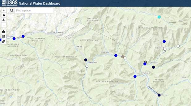
Real Time River Gage Data is available online for Esopus Creek at Alben through the United States Geologic Survey (USGS) ‘National Water Dashboard’ (website). The National Weather Service (NWS) provides additional real time gauge data and watches, warnings, or advisories for Ulster County.
Example of River Gage Data with Flood Categories
Esopus Creek at Allaben, (NY) Historical Crests
USGS Current Conditions for USGS 01362200 ESOPUS CREEK AT ALLABEN NY
- 16.34 ft on 08/28/2011
- 15.10 ft on 03/30/1951
- 14.44 ft. on 04/02/2005
- 13.58 ft. on 01/19/1996
- 10.91 ft. on 09/18/2004
Explore real time river gage data on the interactive USGS National Water Dashboard at USGS | National Water Dashboard.